Ovid, Colorado
Ovid is a statutory town in Sedgwick County, Colorado, United States. The population was 271 at the 2020 census.[5]
Ovid, Colorado | |
|---|---|
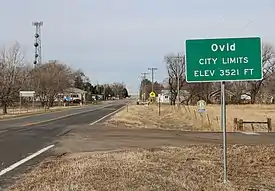 Entering from the east on U.S. Route 138. | |
 Location of Ovid in Sedgwick County, Colorado. | |
| Coordinates: 40°57′36″N 102°23′20″W | |
| Country | |
| State | |
| County[1] | Sedgwick |
| Incorporated (town) | December 21, 1925[2] |
| Government | |
| • Type | Statutory Town[1] |
| Area | |
| • Total | 0.16 sq mi (0.40 km2) |
| • Land | 0.16 sq mi (0.40 km2) |
| • Water | 0.00 sq mi (0.00 km2) |
| Elevation | 3,533 ft (1,077 m) |
| Population | |
| • Total | 271 |
| • Density | 1,700/sq mi (680/km2) |
| Time zone | UTC-7 (Mountain (MST)) |
| • Summer (DST) | UTC-6 (MDT) |
| ZIP code[6] | 80744 |
| Area code | 970 |
| FIPS code | 08-56475 |
| GNIS feature ID | 0182695 |
| Website | Town of Ovid |
History
The town was named after Newton Ovid, a local resident.[7]
Geography
Ovid is located at 40°57′36″N 102°23′20″W (40.959919, -102.388851).[8]
According to the United States Census Bureau, the town has a total area of 0.2 square miles (0.52 km2), all of it land.
Demographics
| Census | Pop. | Note | %± |
|---|---|---|---|
| 1930 | 649 | — | |
| 1940 | 687 | 5.9% | |
| 1950 | 664 | −3.3% | |
| 1960 | 571 | −14.0% | |
| 1970 | 463 | −18.9% | |
| 1980 | 439 | −5.2% | |
| 1990 | 349 | −20.5% | |
| 2000 | 330 | −5.4% | |
| 2010 | 318 | −3.6% | |
| 2020 | 271 | −14.8% |
See also
References
- "Active Colorado Municipalities". State of Colorado, Department of Local Affairs. Archived from the original on 2009-12-12. Retrieved 2007-09-01.
- "Colorado Municipal Incorporations". State of Colorado, Department of Personnel & Administration, Colorado State Archives. 2004-12-01. Retrieved 2007-09-02.
- "2019 U.S. Gazetteer Files". United States Census Bureau. Retrieved July 1, 2020.
- "US Board on Geographic Names". United States Geological Survey. 2007-10-25. Retrieved 2008-01-31.
- United States Census Bureau. "Ovid town; Colorado". Retrieved April 20, 2023.
- "ZIP Code Lookup". United States Postal Service. Archived from the original (JavaScript/HTML) on November 4, 2010. Retrieved November 28, 2007.
- Dawson, John Frank. Place names in Colorado: why 700 communities were so named, 150 of Spanish or Indian origin. Denver, CO: The J. Frank Dawson Publishing Co. p. 39.
- "US Gazetteer files: 2010, 2000, and 1990". United States Census Bureau. 2011-02-12. Retrieved 2011-04-23.
External links
Wikimedia Commons has media related to Ovid, Colorado.
Municipalities and communities of Sedgwick County, Colorado, United States | ||
|---|---|---|
| Towns |  Map of Colorado highlighting Sedgwick County | |
This article is issued from Wikipedia. The text is licensed under Creative Commons - Attribution - Sharealike. Additional terms may apply for the media files.