Manzanola, Colorado
The Town of Manzanola is a Statutory Town in Otero County, Colorado, United States. The town population was 341 at the 2020 United States Census.[5]
Town of Manzanola, Colorado | |
|---|---|
 | |
 Location of Manzanola in Otero County, Colorado. | |
| Coordinates: 38°6′33″N 103°52′4″W | |
| Country | |
| State | |
| County[1] | Otero |
| Incorporated (town) | July 9, 1900[2] |
| Government | |
| • Type | Statutory Town[1] |
| Area | |
| • Total | 0.28 sq mi (0.74 km2) |
| • Land | 0.28 sq mi (0.74 km2) |
| • Water | 0.00 sq mi (0.00 km2) |
| Elevation | 4,255 ft (1,297 m) |
| Population | |
| • Total | 341 |
| • Density | 1,200/sq mi (460/km2) |
| Time zone | UTC-7 (Mountain (MST)) |
| • Summer (DST) | UTC-6 (MDT) |
| ZIP code[6] | 81050 |
| Area code | 719 |
| FIPS code | 08-48500 |
| GNIS feature ID | 0204826 |
| Website | www |
Description
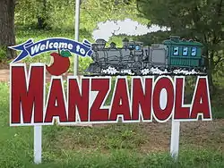
A post office called Manzanola has been in operation since 1895.[7] The town was named for an orchard near the original town site, Manzanola being a name derived from Spanish meaning "red apple".[8]
Manzanola was previously known as Town of Grams Ranch, Town of Apishipa, and the Town of Catlin, in consecutive order.[9]
Geography
Manzanola is located at 38°6′33″N 103°52′4″W (38.109096, -103.867739).[10]
According to the United States Census Bureau, the town has a total area of 0.3 square miles (0.78 km2), all of it land.
Demographics
| Census | Pop. | Note | %± |
|---|---|---|---|
| 1910 | 428 | — | |
| 1920 | 562 | 31.3% | |
| 1930 | 578 | 2.8% | |
| 1940 | 531 | −8.1% | |
| 1950 | 543 | 2.3% | |
| 1960 | 562 | 3.5% | |
| 1970 | 451 | −19.8% | |
| 1980 | 459 | 1.8% | |
| 1990 | 437 | −4.8% | |
| 2000 | 525 | 20.1% | |
| 2010 | 434 | −17.3% | |
| 2020 | 341 | −21.4% | |
| U.S. Decennial Census | |||
Transportation
Manzanola is part of Colorado's Bustang network. Is it along the Lamar-Pueblo-Colorado Springs Outrider line.[11]
References
- "Active Colorado Municipalities". State of Colorado, Department of Local Affairs. Archived from the original on 2009-12-12. Retrieved 2007-09-01.
- "Colorado Municipal Incorporations". State of Colorado, Department of Personnel & Administration, Colorado State Archives. 2004-12-01. Retrieved 2007-09-02.
- "2019 U.S. Gazetteer Files". United States Census Bureau. Retrieved July 1, 2020.
- "US Board on Geographic Names". United States Geological Survey. 2007-10-25. Retrieved 2008-01-31.
- United States Census Bureau. "Manzanola town; Colorado". Retrieved April 21, 2023.
- "ZIP Code Lookup". United States Postal Service. Archived from the original (JavaScript/HTML) on November 4, 2010. Retrieved November 18, 2007.
- "Post offices". Jim Forte Postal History. Retrieved 1 July 2016.
- Dawson, John Frank. Place names in Colorado: why 700 communities were so named, 150 of Spanish or Indian origin. Denver, CO: The J. Frank Dawson Publishing Co. p. 34.
- Fowler, Christian Burney (April 25, 2019). "Manzanola United Methodist Church enters Otero County historic register". Fowler Tribune. Retrieved 2019-04-28.
- "US Gazetteer files: 2010, 2000, and 1990". United States Census Bureau. 2011-02-12. Retrieved 2011-04-23.
- "Bustang Schedule". RideBustang. CDOT.
External links
Municipalities and communities of Otero County, Colorado, United States | ||
|---|---|---|
| Cities |  Map of Colorado highlighting Otero County | |
| Towns | ||
| CDPs | ||
| Unincorporated communities | ||
| Ghost town | ||
| Footnotes | ‡This populated place also has portions in an adjacent county or counties | |