List of communities in Dubai
The administrative structure of the Emirate of Dubai is organized on two levels: the first level is made up of the Sectors, the second level is made up of the Communities (sometimes also referred to as Districts).[1]
This subdivision is not linked to historical or ethnic reasons, but to administrative management and planning needs. Indeed the collection of data on population distribution by sector/community is significant for planning purposes and provides information portraying the picture of population size in each region that planners and decision makers can use to generate correct plans and programs taking into account the context of each community and the needs of public facilities and services of each of them.[1]
This subdivision does not uniquely identify the city of Dubai and therefore does not distinguish between communities belonging to the metropolitan nucleus itself and those belonging to the suburbs or suburbs. However, help to make this distinction comes from the 2020 Dubai Urban Plan. This plan divides the territory of the Emirate into four areas, which reflect distinctive environmental and landscape qualities as well as urban settlement characteristics and land use functions. These areas are:[2]
- Area 1: Offshore Sensitive Urban Area (within 12 nautical miles from the coast);
- Area 2: Metropolitan Urban Area (west of the Outer Bypass Road (E 611 or "Emirates Road"));
- Area 3: Non-urban area (desert lands including land uses for: equestrian sports and camel racing, conservation areas, non-urban settlements);
- Area 4: Non-urban area (desert lands including land uses for: aquiferous areas, gas extraction areas, agricultural settlements);
On the basis of this distinction, the metropolitan area of Dubai can therefore be defined as the portion of land between the E 311 and the coast. This area coincides, net of some small portions, with that subtended by Sectors 1 to 6, also including the offshore area of the artificial islands, whose communities therefore constitute the urban nucleus of the city of Dubai.
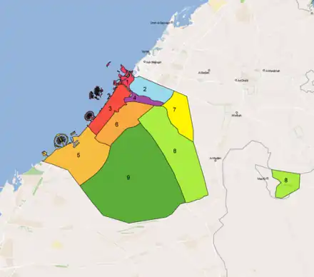
Sectors
The Sectors of Dubai, (in Arabic القطاع, transliterated Al-Qiṭā), are 9.[1]
Below are the Sectors with their surface area[3] and population updated to 2021,[1] as indicated by the referenced reports of the Dubai Statistic Center.
| Sector | Arabic name | Community | Area (km²) |
Population (2021) |
Map |
|---|---|---|---|---|---|
| Sector 1 | 1 القطاع | 23 | 124.90 | 493,555 | 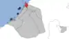 |
| Sector 2 | 2 القطاع | 35 | 174.50 | 647,632 | 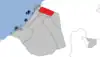 |
| Sector 3 | 3 القطاع | 57 | 326.60 | 1,253,422 | 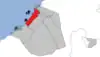 |
| Sector 4 | 4 القطاع | 10 | 61.80 | 91,940 | 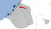 |
| Sector 5 | 5 القطاع | 18 | 1,046.50 | 503,472 | 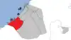 |
| Sector 6 | 6 القطاع | 32 | 292.40 | 414,273 | 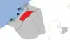 |
| Sector 7 | 7 القطاع | 7 | 228.80 | 15,145 | 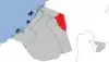 |
| Sector 8 | 8 القطاع | 16 | 839.00 | 40,906 | 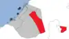 |
| Sector 9 | 9 القطاع | 28 | 1,663.90 | 17,955 | 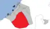 |
| Dubai | دبيّ | 226 | 4,758.50 | 3,478,300 |
Community
The Communities (in Arabic: المنطقة ) are the second tier of the administrative structure of the Emirate of Dubai. As of December 31, 2021, there were 226 Communities divided into nine Sectors.[4]
Below are the Communities broken down by Sector, with their area [3] and population updated to 2021,[1] as indicated in the referenced reports of the Dubai Statistic Center.
Sector 1
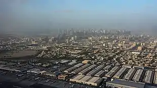
This Sector is spread over the northern coastal area of Dubai, on the north bank of the Dubai Creek. Corresponds to the historic district of Deira and its artificial island. With a population of around 494,000 residents on an area of just under 125 km², it is the most densely populated sector (density of around 3,950 inhab./km²).
| Code Community |
Name Community | Name Arabic | Area (km2) | Population (2021) |
|---|---|---|---|---|
| 101 | Nakhlat Deira | نخلة ديرة | 99.6 | 2 |
| 111 | Al Corniche | الكورنيش | 0.6 | 2,593 |
| 112 | Al Ras | الراس | 0.3 | 8,067 |
| 113 | Al Dhagaya | الضغاية | 0.2 | 16,723 |
| 114 | Al Buteen | البطين | 0.1 | 3,016 |
| 115 | Al Sabkha | السبخة | 0.1 | 4,205 |
| 116 | Ayal Nasir | عيال ناصر | 0.2 | 19,820 |
| 117 | Al Murar | المرر | 0.4 | 40,105 |
| 118 | Naif | نايف | 0.7 | 53,075 |
| 119 | Al Rigga | الرقة | 0.7 | 11,097 |
| 121 | Corniche Deira | كورنيش ديرة | 0.9 | 15 |
| 122 | Al Baraha | البراحة | 1.0 | 25,839 |
| 123 | Al Muteena | المطينة | 1.1 | 48,739 |
| 124 | Al Muraqqabat | المرقبات | 1.5 | 73,087 |
| 125 | Rigga Al Buteen | رقة البطين | 0.8 | 7,538 |
| 126 | Abu Hail | أبو هيل | 1.3 | 18,043 |
| 127 | Hor Al Anz | هورالعنز | 1.8 | 84,661 |
| 128 | Al Khabisi | الخبيصي | 1.2 | 2,011 |
| 129 | Port Saeed | بور سعيد | 2.7 | 14,241 |
| 131 | Al Hamriya Port | ميناء الحمرية | 1.2 | 510 |
| 132 | Al Waheda | الوحيدة | 1.4 | 21,608 |
| 133 | Hor Al Anz East | هور العنز شرق | 1.4 | 22,026 |
| 134 | Al Mamzar | الممزر | 5.8 | 16,534 |
Sector 2
This Sector is in the northern area of Dubai, on the border with the Emirate of Sharjah. Within its territory are some of Dubai's most populous neighborhoods and communities, including Muhaisnah, Mirdif, Al Nahda and Al Qusais. The Dubai International Airport and Mushrif Public Park are also located in the sector.

| Code Community |
Name Community | Name Arabic | Area (km2) | Population (2021) |
|---|---|---|---|---|
| 213 | Nad Shamma | ند شما | 1.1 | 3,305 |
| 214 | Al Garhoud | القرهود | 4.0 | 19,726 |
| 215 | Umm Ramool | أم رمول | 3.6 | 3,069 |
| 216 | Al Rashidiya | الراشدية | 4.8 | 38,425 |
| 221 | Dubai Airport | مطار دبي الدولي | 14.2 | 121 |
| 226 | Al Twar First | الطوار الأولى | 2.6 | 12,114 |
| 227 | Al Twar Second | الطوار الثانية | 1.1 | 5,068 |
| 228 | Al Twar Third | الطوار الثالثة | 3.0 | 11,185 |
| 231 | Al Nahda First | النهدة الأولى | 1.7 | 32,757 |
| 232 | Al Qusais First | القصيص الأولى | 2.7 | 48,378 |
| 233 | Al Qusais Second | القصيص الثانية | 1.8 | 12,851 |
| 234 | Al Qusais Third | القصيص الثالثة | 2.3 | 7,513 |
| 241 | Al Nahda Second | النهدة الثانية | 2.2 | 64,458 |
| 242 | Al Qusais Industrial First | القصيص الصناعية الأولى | 1.4 | 10,813 |
| 243 | Al Qusais Industrial Second | القصيص الصناعية الثانية | 1.7 | 9,410 |
| 244 | Muhaisnah Third | محيصنة الثالثة | 1.8 | 6,865 |
| 245 | Muhaisnah Fourth | محيصنة الرابعة | 2.3 | 35,861 |
| 246 | Al Qusais Industrial Third | القصيص الصناعية الثالثة | 0.9 | 2,802 |
| 247 | Al Qusais Industrial Fourth | القصيص الصناعية الرابعة | 0.7 | 2,865 |
| 248 | Al Qusais Industrial Fifth | القصيص الصناعية الخامسة | 2.4 | 2,722 |
| 251 | Mirdif | مردف | 9.4 | 66,736 |
| 252 | Mushrif | مشرف | 10.5 | 70 |
| 261 | Muhaisnah First | محيصنة الأولى | 5.0 | 8,616 |
| 262 | Al Mizhar First | المزهر الأولى | 6.9 | 17,498 |
| 263 | Al Mizhar Second | المزهر الثانية | 4.3 | 11,967 |
| 264 | Muhaisnah Second | محيصنة الثانية | 5.6 | 148,832 |
| 265 | Oud Al Muteen First | عود المطينة الأولى | 3.6 | 15,514 |
| 266 | Oud Al Muteen Second | عود المطينة الثانية | 2.4 | 5,820 |
| 267 | Muhaisnah Fifth | محصينة الخامسة | 2.7 | 2 |
| 268 | Oud Al Muteen Third | عود المطينة الثالثة | 1.4 | 7,061 |
| 271 | Wadi Alamardi | وادي العمردي | 24.2 | 3,565 |
| 281 | Al Khawaneej One | الخوانيج الأولى | 16.4 | 13,634 |
| 282 | Al Khawaneej Two | الخوانيج الثانية | 12.7 | 5,507 |
| 283 | Al Ayas | العياص | 10.5 | 1,843 |
| 284 | Al Ttay | الطي | 3.3 | 10,659 |
Sector 3
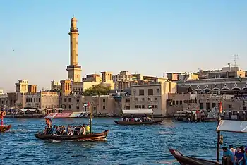
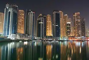
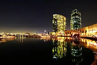
This Sector extends along the central coastal area of Dubai, and on the southern bank of the Dubai Creek and includes the districts of Bur Dubai, Jumeirah, and the territories of their immediate hinterland. It therefore includes the districts of Zabeel, the Financial District of Dubai made up of the Trade Center 1 and Trade Center 2 and Downtown Dubai with the Burj Khalifa . Along the coast it includes the port area of Al MIna with Port Rashed to the north, and the new residential district of Dubai Marina to the south. All the artificial islands in front of the relative section of coast are also part of the sector. It is the most populous sector of Dubai with an attendance of over 1,200,000 residents (2021 data).
.jpg.webp)
| Code Community |
Name Community | Name Arabic | Area (km2) | Population (2021) |
|---|---|---|---|---|
| 302 | Jumeirah Bay | شاطئ جميرا | 1.0 | 41 |
| 303 | World Islands | جزر العالم | 74.1 | 7 |
| 304 | Jumeirah Island 2 | جزيرة جميرا 2 | 0.1 | 3 |
| 311 | Al Shindagha | الشندغة | 0.3 | 7 |
| 312 | Al Souk Al Kabir | السوق الكبير | 0.9 | 52,439 |
| 313 | Al Hamriya | الحمرية | 0.8 | 38,215 |
| 314 | Umm Hurair First | أم هرير الأولى | 1.0 | 6,482 |
| 315 | Umm Hurair Second | أم هرير الأولى | 3.4 | 5,633 |
| 316 | Al Rifa | الرفاعة | 1.2 | 48,546 |
| 317 | Al Mankhool | المنخول | 2.0 | 41,244 |
| 318 | Al Karama | الكرامة | 2.1 | 76,591 |
| 319 | Oud Metha | عود ميثاء | 1.5 | 15,568 |
| 321 | Madinat Dubai Al Melaheyah (Al Mina) | مدينه دبي المالحيه | 22.1 | 8,391 |
| 322 | Al Hudaiba | الحضيبة | 0.9 | 14,504 |
| 323 | Al Jafiliya | الجافلية | 1.7 | 25,033 |
| 324 | Al Kifaf | الكفاف | 0.8 | 602 |
| 325 | Zabeel First | زعبيل الأولى | 4.1 | 3,449 |
| 326 | Al Jaddaf | الجداف | 7.2 | 6,947 |
| 332 | Jumeirah First | جميرا الأولى | 10.0 | 21,496 |
| 333 | Al Bada | البدع | 2.0 | 58,437 |
| 334 | Al Satwa | السطوة | 2.7 | 40,997 |
| 335 | Trade Center 1 | المركز التجاري الأولى | 0.8 | 17,676 |
| 336 | Trade Center 2 | المركز التجاري الثانية | 1.4 | 13,515 |
| 337 | Zabeel Second | زعبيل الثانية | 10.8 | 8,568 |
| 342 | Jumeirah Second | جميرا الثانية | 3.3 | 10,660 |
| 343 | Al Wasl | الوصل | 4.9 | 12,185 |
| 345 | Burj Khalifa (Downtown Dubai) | برج خليفة | 2.7 | 21,862 |
| 346 | Al Kalij Al Tejari (Business Bay) | الخليج التجاري | 6.6 | 23,943 |
| 347 | Al Markada | المركاض | 10.4 | 1,817 |
| 352 | Jumeirah Third | جميرا الثالثة | 3.4 | 14,188 |
| 353 | Al Safa First | الصفا الأولى | 2.4 | 9,043 |
| 354 | Al Quoz First | القوز الاولى | 3.6 | 21,322 |
| 355 | Al Quoz Second | القوز الثانية | 5.3 | 5,543 |
| 356 | Umm Suqeim First | أم سقيم الأولى | 2.8 | 12,468 |
| 357 | Al Safa Second | الصفا الثانية | 1.9 | 7,062 |
| 358 | Al Quoz Third | القوز الثالثة | 2.4 | 50,190 |
| 359 | Al Quoz Fourth | القوز الرابعة | 2.2 | 21,691 |
| 362 | Umm Suqeim Second | أم سقيم الثانية | 3.2 | 13,236 |
| 363 | Al Manara | المنارة | 2.2 | 8,745 |
| 364 | Al Quoz Industrial First | القوز الصناعية الأولى | 4.8 | 28,060 |
| 365 | Al Quoz Industrial Second | القوز الصناعية الثانية | 5.1 | 128,867 |
| 366 | Umm Suqeim Third | أم سقيم الثالثة | 2.6 | 7,777 |
| 367 | Umm Al Sheif | أم الشيف | 1.8 | 4,618 |
| 368 | Al Quoz Industrial Third | القوز الصناعية الثالثة | 4.4 | 17,306 |
| 369 | Al Quoz Industrial Fourth | القوز الصناعية الرابعة | 4.7 | 38,761 |
| 372 | Al Sufouh First | الصفوح الأولى | 5.9 | 4,686 |
| 373 | Al Barsha First | البرشاء الأولى | 4.0 | 41,532 |
| 375 | Al Barsha Third | البرشاء الثالثة | 4.9 | 15,401 |
| 376 | Al Barsha Second | البرشاء الثانية | 6.4 | 16,417 |
| 381 | Nakhlat Jumeira | نخلة جميرا | 26.7 | 25,050 |
| 382 | Al Sufouh Second | الصفوح الثانية | 4.3 | 6,478 |
| 383 | Al Thanyah First | الثنيه الأولى (قرية ربيع الصحراء) | 1.1 | 25,778 |
| 384 | Al Thanyah Second | الثنيه الثانية (مضمار جبل علي) | 6.2 | 0 |
| 388 | Al Thanyah Third | الثنيه الثالثة (تلال الامارات الثانية) | 3.8 | 22,394 |
| 392 | Marsa Dubai | مرسى دبي (الميناء السياحي) | 8.9 | 62,570 |
| 393 | Al Thanyah Fifth | الثنيه الخامسة (تلال الامارات الاولى) | 9.7 | 40,957 |
| 394 | Al Thanyah Fourth | الثنيه الرابعة (تلال الامارات الثالثة) | 11.1 | 28,424 |
Sector 4

This Sector is developed in the central-northern area of Dubai. It includes the area of Ras Al Khor with its protected nature reserve and the territories east of this area. Therefore, the new districts of Dubai Festival City and Dubai Creek Harbour and the areas of Nad Al Hammar, Al Warqaa and Wadi Alshabak fall within it. It is the smallest of Dubai's sectors with an area of just 61.8 km².
| Code Community |
Name Community | Name Arabic | Area (km2) | Population (2021) |
|---|---|---|---|---|
| 412 | Al Kheeran (Dubai Festival City) | الخيران | 6.3 | 5,270 |
| 413 | Ras Al Khor | رأس الخور | 7.8 | 2 |
| 415 | Al Khairan First (Dubai Creek Harbour) | الخيران الأولى | 7.3 | 2,086 |
| 416 | Nad Al Hammar | ند الحمر | 8.3 | 16,930 |
| 421 | Al Warqaa First | الورقاء الأولى | 2.4 | 26,405 |
| 422 | Al Warqaa Second | الورقاء الثانية | 3.6 | 11,323 |
| 423 | Al Warqaa Third | الورقاء الثالثة | 6.2 | 15,613 |
| 424 | Al Warqaa Fourth | الورقاء الرابعة | 5.1 | 14,308 |
| 425 | Al Warqaa Fifth | الورقاء الخامسة | 4.3 | 0 |
| 431 | Wadi Alshabak | وادي الشبك | 10.5 | 3 |
Sector 5
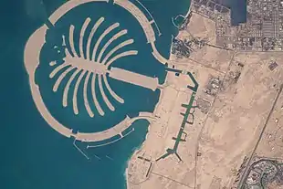
This Sector extends along the southern coast of Dubai, from Marsa Dubai in the north to the border with the Emirate of Abu Dhabi in the south. It includes the large area of Jabal Ali with its port and related industrial zone, the artificial island of Palm Jebel Ali and the developing Al Wajeha Al Bahriah (Dubai Waterfront), as well as the residential area of Dubai Investment Park and the development area of Madinat Al Mataar, also called Dubai South, which hosted the Expo 2020 and is home to the new Al Maktoum International Airport.
| Code Community |
Name Community | Name Arabic | Area (km2) | Population (2021) |
|---|---|---|---|---|
| 501 | Nakhlat Jabal Ali | نخلة جبل علي | 58.1 | 5 |
| 502 | Al Wajeha Al Bahriah | الواجهة البحرية | 124.7 | 4 |
| 511 | Hessyan First | حصيان الاولى | 23.8 | 3,341 |
| 512 | Hessyan Second | حصيان الثانية | 51.9 | 10,381 |
| 513 | Saih Shuaib 1 | سيح شعيب 1 | 41.6 | 16 |
| 516 | Jabal Ali Industrial Third | جبل علي الصناعية الثالثة | 30.0 | 0 |
| 518 | Jabal Ali Industrial Second | جبل علي الصناعية الثانية | 32.6 | 28,000 |
| 521 | Madinat Al Mataar | مدينة المطار | 141.8 | 4,150 |
| 531 | Saih Shuaib 2 | سيح شعيب 2 | 22.3 | 12,629 |
| 532 | Saih Shuaib 3 | سيح شعيب 3 | 16.0 | 4,684 |
| 533 | Saih Shuaib 4 | سيح شعيب 4 | 19.4 | 10,766 |
| 591 | Jabal Ali First | جبل علي الأولى | 21.3 | 77,363 |
| 592 | Jabal Ali Second | جبل علي الثانية | 5.1 | 1,008 |
| 593 | Jabal Ali Third | جبل علي الثالثة | 365.0 | 218 |
| 594 | Mena Jabal Ali | ميناء جبل علي | 34.8 | 9,467 |
| 597 | Dubai Investment Park Second | مجمع دبي للاستثمار الثاني | 18.8 | 80,118 |
| 598 | Dubai Investment Park First | مجمع دبي للاستثمار الأول | 17.2 | 63,094 |
| 599 | Jabal Ali Industrial First | جبل علي الصناعية الأولى | 22.1 | 198,228 |
Sector 6
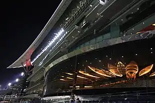
This Sector is located in the central area of the Emirate of Dubai. It is broadly bounded by Emirates Road (E 611) to the east, Al Yalayis Street (D 57) to the south, Sheikh Mohammed Bin Zayed Road (E 311) before and Al Khail Road (E 44) then, west and by the Ras Al Khor Road (E 44) north. It includes among others: the vast industrial area of Ras Al Khor, the residential areas of Nad Al Sheba and Wadi Al Safa, the area of Warsan with the residential complex of the Dubai International City within it. The largest community in the sector is that of Hadaeq Sheikh Mohammed Bin Rashid (literally "Sheikh Mohammed bin Rashid Gardens") which is also known as Mohammed Bin Rashid City, which contains prestigious residential complexes and luxury villas.
| Code Community |
Name Community | Name Arabic | Area (km2) | Population (2021) |
|---|---|---|---|---|
| 611 | Bu Kadra | بو كدرة | 1.7 | 112 |
| 612 | Ras Al Khor Industrial First | رأس الخور الصناعية الأولى | 2.6 | 2,160 |
| 613 | Ras Al Khor Industrial Second | رأس الخور الصناعية الثانية | 4.2 | 1,833 |
| 614 | Ras Al Khor Industrial Third | رأس الخور الصناعية الثالثة | 5.4 | 22,247 |
| 615 | Nadd Al Shiba Second | ند الشبا الثانية | 7.5 | 2,569 |
| 616 | Nadd Al Shiba Third | ند الشبا الثالثة | 6.3 | 1,137 |
| 617 | Nadd Al Shiba Fourth | ند الشبا الرابعة | 6.2 | 3,898 |
| 618 | Nadd Al Shiba First | ند الشبا الأولى | 21.7 | 6,589 |
| 621 | Warsan First | ورسان الاولى | 8.4 | 108,176 |
| 622 | Warsan Second | ورسان الثانية | 8.6 | 1,409 |
| 624 | Warsan Fourth | ورسان الرابعة | 7.9 | 10,104 |
| 626 | Nadd Hessa | ند حصة | 9.8 | 40,819 |
| 631 | Hadaeq Sheikh Mohammed Bin Rashid | حدائق الشيخ محمد بن راشد | 38.7 | 3,356 |
| 643 | Wadi Al Safa 2 | وادي الصفا 2 | 10.5 | 10,890 |
| 645 | Wadi Al Safa 3 | وادي الصفا 3 | 30.2 | 10,270 |
| 646 | Wadi Al Safa 4 | وادي الصفا 4 | 6.9 | 167 |
| 648 | Wadi Al Safa 5 | وادي الصفا 5 | 16.3 | 20,479 |
| 664 | Wadi Al Safa 6 | وادي الصفا 6 | 7.8 | 18,856 |
| 665 | Wadi Al Safa 7 | وادي الصفا 7 | 8.4 | 8,957 |
| 671 | Al Barsha South First | البرشاء جنوب الاولى | 5.9 | 14,500 |
| 672 | Al Barsha South Second | البرشاء جنوب الثانية | 4.8 | 7,239 |
| 673 | Al Barsha South Third | البرشاء جنوب الثالثة | 3.7 | 8,573 |
| 674 | Al Hebiah First | الحبيه الاول | 4.2 | 11,155 |
| 675 | Al Hebiah Second | الحبيه الثانية | 3.3 | 781 |
| 676 | Al Hebiah Third | الحبيه الثالثة | 4.3 | 7,238 |
| 677 | Al Hebiah Sixth | الحبيه السادسة | 3.3 | 2,455 |
| 681 | Al Barsha South Fourth | البرشاء جنوب الرابعة | 6.8 | 29,087 |
| 682 | Al Hebiah Fourth | الحبيه الرابعة | 9.1 | 21,609 |
| 683 | Al Hebiah Fifth | الحبيه الخامسة | 8.1 | 10,302 |
| 684 | Al Barsha South Fifth | البرشاء جنوب الخامسة | 3.0 | 7,809 |
| 685 | Me'aisem First | معيصم الأول | 16.4 | 18,484 |
| 686 | Me'aisem Second | معيصم الثانية | 10.4 | 13 |
Sector 7
This Sector is located in the northeastern part of the Emirate of Dubai and is bordered to the north and east by the Emirate of Sharjah. The outer boundary is marked on the north by Maleha Road and on the east by Nazwa Road, while the inner boundaries with the other sectors are marked by the Emirates Road on the northwest, and on the southwest by the Al Awir Road. (E 44) which however in that stretch takes the name of Dubai-Hatta Road.
The Sector is part of the Non-Urban Area of Dubai and contains sparsely populated communities, such as Al Awir, Lehbab, Al Meryal and Nazwah and mostly desert areas and almost uninhabited like Al Wohoosh and Enkhali. For these reasons, the sector is the least populated with a presence of just over 15,000 residents (2021 data).
| Code Community |
Name Community | Name Arabic | Area (km2) | Population (2021) |
|---|---|---|---|---|
| 711 | Al Awir First | العوير الأولى | 39.7 | 4,488 |
| 721 | Al Awir Second | العوير الثانية | 52.4 | 5,874 |
| 724 | Enkhali | نخلي | 49.0 | 2 |
| 727 | Al Wohoosh | الوحوش | 25.4 | 48 |
| 731 | Lehbab First | لهباب الأولى | 33.8 | 3,389 |
| 735 | Al Meryal | المريال | 15.5 | 769 |
| 736 | Nazwah | نزوه | 13.1 | 575 |
Sector 8
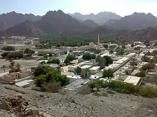
This Sector is located in the east-central area of the Emirate of Dubai and borders on the Emirate of Sharjah to the east and the Emirate of Abu Dhabi to the south. The external border to the east and south coincides with the analogous borders of the Dubai Desert Conservation Reserve, which occupies a large part of the southern surface of the Sector. The Sector also includes the community of Hatta which constitutes an exclave of Dubai located in the Hajar Mountains. The territory is part of the Dubai Non-Urban Area which consists mainly of desert lands, conservation areas and non-urban settlements. Apart from Hatta and the communities north of the territory of Warsan, and parts of Al Rowaiyah, the other communities are sparsely populated if not entirely without residents.
.jpg.webp)
| Code Community |
Name Community | Name Arabic | Area (km2) | Population (2021) |
|---|---|---|---|---|
| 811 | Warsan 3 | ورسان الثالثة | 10.4 | 12,613 |
| 812 | Al Rowaiyah First | الرويه الأولى | 11.5 | 3,263 |
| 813 | Al Rowaiyah Second | الرويه الثانية | 7.5 | 0 |
| 814 | Al Rowaiyah Third | الرويه الثالثة | 60.0 | 4,897 |
| 821 | Mereiyeel | مرييل | 30.7 | 424 |
| 824 | Umm Al Daman | أم الدمن | 35.2 | 299 |
| 826 | Le Hemaira | الحميرا | 36.4 | 56 |
| 831 | Lehbab Second | لهباب الثانية | 63.2 | 1,601 |
| 835 | Umm Al Mo'meneen | أم المؤمنين | 32.7 | 169 |
| 841 | Margham | مرغم | 152.6 | 1,217 |
| 845 | Al Maha | المها | 41.7 | 205 |
| 847 | Umm Eselay | أم السلي | 35.2 | 216 |
| 851 | Remah | رماح | 82.9 | 195 |
| 857 | Margab | مرقب | 34.6 | 666 |
| 861 | Yaraah | يراح | 76.5 | 100 |
| 891 | Hatta | حتا | 128.8 | 14,985 |
Sector 9
.jpg.webp)
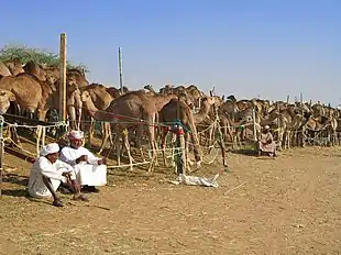
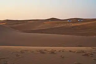
This Sector is located in the central and southern area of the Emirate of Dubai, of which it occupies a large part. It is bordered by Emirate of Abu Dhabi to the south and west. The territory is part of the Dubai Non-Urban Area which consists largely of desert lands, aquifers, gas fields, conservation areas and agricultural settlements. Inside is the Al Marmoom Desert Conservation Reserve, which is the largest reserve in the Emirates, with its famous Qudra lakes. The Sector is the largest of Dubai's sectors with an area of approximately 1,664 km², but the least densely populated, with fewer than 18,000 residents (density of approximately 10.8 inhab./km²).
| Code Community |
Name Community | Name Arabic | Area (km2) | Population (2021) |
|---|---|---|---|---|
| 911 | Umm Nahad First | أم نهد الأولى | 14.1 | 8 |
| 912 | Umm Nahad Second | أم نهد الثانية | 8.5 | 2 |
| 913 | Umm Nahad Third | أم نهد الثالثة | 15.3 | 3,623 |
| 914 | Umm Nahad Fourth | أم نهد الرابعة | 46.0 | 4 |
| 915 | Al Yufrah 1 | اليفره 1 | 17.5 | 403 |
| 916 | Al Yufrah 2 | اليفره 2 | 4.3 | 1,593 |
| 917 | Al Marmoom | المرموم | 27.3 | 141 |
| 918 | Al Yufrah 3 | اليفره 3 | 11.1 | 1,539 |
| 919 | Al Yufrah 4 | اليفره 4 | 11.8 | 3 |
| 921 | Al Yalayis 1 | الياليس 1 | 17.8 | 1,679 |
| 922 | Al Yalayis 2 | الياليس 2 | 14.3 | 3,685 |
| 923 | Al Yalayis 3 | الياليس 3 | 12.3 | 4 |
| 924 | Al Yalayis 4 | الياليس 4 | 13.2 | 8 |
| 925 | Al Yalayis 5 | الياليس 5 | 25.2 | 88 |
| 931 | Al Lesaily | الليسيلي | 112.7 | 2,950 |
| 941 | Grayteesah | قريطيسه | 91.8 | 58 |
| 945 | Al Fagaa | الفقع | 140.5 | 442 |
| 951 | Saih Al Salam | سيح السلم | 88.7 | 615 |
| 956 | Al Hathmah | الحثمة | 82.3 | 37 |
| 961 | Al Selal | الصلال | 170.7 | 684 |
| 967 | Ghadeer Barashy | غدير براشي | 70.9 | 33 |
| 971 | Saih Al Dahal | سيح الدحل | 190.2 | 3 |
| 975 | Al O'shoosh | العشوش | 58.9 | 3 |
| 978 | Saih Shua'alah | سيح شعيله | 69.5 | 3 |
| 981 | Mugatrah | مقطره | 139.9 | 347 |
| 987 | Al Layan 1 | الليان 1 | 28.3 | 0 |
| 988 | Al Layan 2 | الليان 2 | 37.0 | 0 |
| 991 | Hefair | حفير | 143.6 | 0 |
Notes
-
Dubai Statistics Center
.— Op. cited, p. 5-6 -
Dubai Municipality
.— Op. cited, p. 5-15 - Dubai Statistics Center. "Distribution of Estimated Population & Population Density (person/km2) by Sector and Community - Emirate of Dubai (2021)" (PDF). Retrieved 15 September 2022.
-
Population Bulletin 2021
.— pag. 7-13
Bibliography
- Dubai Statistics Center. "Population Bulletin - Emirate of Dubai - 2021" (PDF). Retrieved 6 November 2021.
- Dubai Municipality, Planning Department. "Dubai 2020 Urban Masterplan'" (PDF). Retrieved 19 November 2022.
External links
- "Dubai Statistics Center". Retrieved 8 November 2022.
- "Division of Dubai". Retrieved 12 November 2022.
- "Interactive map of the Emirate of Dubai". Retrieved 12 November 2022.