Halamanning
Halamanning is a hamlet in west Cornwall, England, situated approximately 5.5 miles (8.9 km) east of Penzance and 4 miles (6.4 km) south of Hayle.[1] Halamanning is in the parish of St Hilary (where the population taken at the 2011 census was included ) and is in the Cornwall and West Devon Mining Landscape, which was designated as a World Heritage Site in 2006.
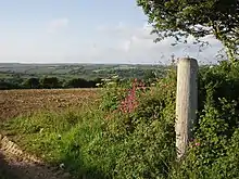
Fields near Halamanning
| Halamanning | |
|---|---|
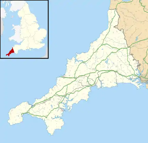 Halamanning Location within Cornwall | |
| OS grid reference | SW558309 |
| Unitary authority | |
| Ceremonial county | |
| Region | |
| Country | England |
| Sovereign state | United Kingdom |
| Post town | PENZANCE |
| Postcode district | TR20 |
| Dialling code | 01736 |
| Police | Devon and Cornwall |
| Fire | Cornwall |
| Ambulance | South Western |
| UK Parliament | |
References
- Ordnance Survey: Landranger map sheet 203 Land's End & Isles of Scilly (Map). Ordnance Survey. 2009. ISBN 978-0-319-23146-3.
External links
- The Penwith Mining District - Halamanning; Cornwall in Focus
| Unitary authorities | |
|---|---|
| Major settlements |
|
| Rivers | |
| Topics | |
This article is issued from Wikipedia. The text is licensed under Creative Commons - Attribution - Sharealike. Additional terms may apply for the media files.